Your Sites, Your Drone Data
Identified allows you to manage and access data on-demand for real-time monitoring of sites. Our drone software gives your team cloud-based access to a full suite of tools and features to reduce the time and cost to completion.
 Build a Project Library with unlimited storage, to reference past and current projects.
 Drive Collaboration by granting access to key members for any given project.
 Invoice with Certainty by verifying billing quantities each cycle.
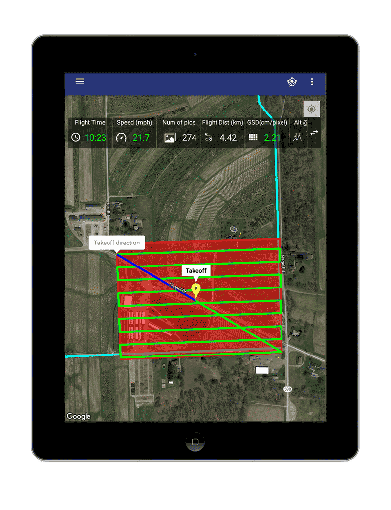
Powerful Drone Mapping App
Prepare, store, and access flights with our easy-to-use Plan IQ app for autonomous mapping of sites. When on-site, no internet access is necessary to view or upload coordinates to the drone for single or multiple flights.
The app ensures all protocols are met with built-in safety features to give you peace of mind during flights.
Actionable Insights
- As-Built vs. As Planned
- Change Detection Technology
- Tracking Cut/Fill
- Volume Calculations
Blueprint Overlay
As-Built vs. As Planned
Easily monitor site development at each stage by comparing your surface contours to your design contours with proven accuracy. Also, the tool can be used to ensure construction (roadway, pipeline, house plan) is taking place on the correct path or area.
- Within our first week, we flew five well-pads and dramatically reduced the time it took us to gather as-built data.
- David Stewart, Keystone Consultants

Change Detection Technology
Change Detection Technology (CDT)
CDT helps you compare surfaces from one flight to a previous drone map or a site grade. Using this tool helps you quickly identify where work has been done and remaining cut/fill locations on a site.
- The biggest issue for change-orders in the world of dirt is realizing there’s more topsoil than anticipated. With Identified, we can easily validate when there is a change to receive payment for it.
- Mike Marshall, Landmark Construction

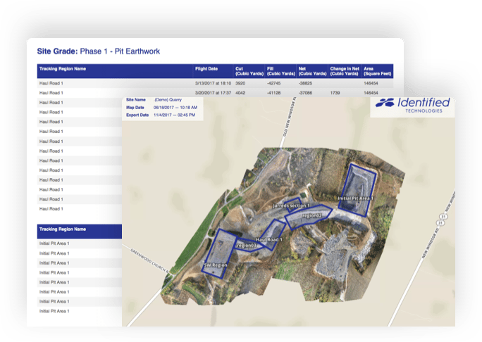
Tracking Cut/Fill
Tracking Cut/Fill
This feature provides you a built-in tool to verify earthwork quantities. With this, you can confirm what material has been moved to specific regions or the entire site.
- Drone flights report our data much quicker. That gives us the flexibility to track it more closely and monitor more efficiently. It allows us to make adjustments in real-time.
- Andy Rhodes, Kokosing Construction

Volume Calculations
Volume Calculations
Be able to monitor material amount for monthly, quarterly and end of year audits for inventory. Get real-time data on every stockpile including density, volume, tonnage, and dollar amount.
- With Identified, we were able to map 180 acres and receive our data the same day. In our business, speed is crucial, and cutting time spent tracking inventory makes work and invoicing much faster.
- Phil Shumaker, Bentley Development

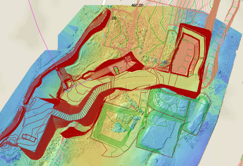
3D Modeling
Click to Rotate and Explore
Create Reports & 2D Maps
Identified gives you the ability to have a variety of reports and 3D models into 2D drone maps to share with your team offline.
With one click, be able to download ready-to-share, in-depth reports such as Quantities, Volumes, Cut/Fill Heat Maps and more!
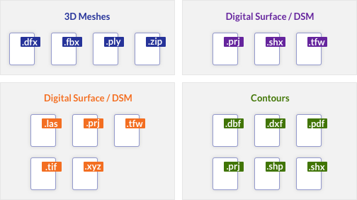
Export Files to CAD & GIS
Share and export drone maps and point clouds into all standard formats and file types to analyze in your preferred CAD and GIS programs. We support and integrate with all applications!
Utilize Any Coordinate System
Whether you are working in local or state systems to gather site data, we have you covered. Identified gives you the flexibility to compare your drone maps to official topography records.