Automatic aerial job site tracking lets you securely share progress and collaborate with stakeholders to ensure projects never go late or over budget. Your Award Winning Boomerang system subscription continuously monitors productivity over time, improving accuracy, speed, profitability, client satisfaction and safety.
Industry leading project management technology empowers you to make fast, informed decisions. Know when others guess™.
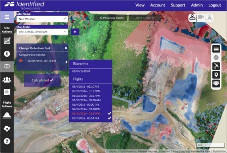
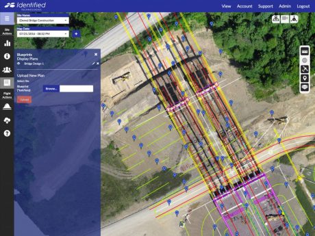
As Built vs As Planned Overlay
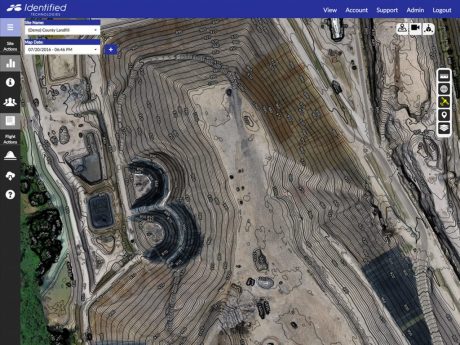
Excavation Progress Tracking
Highway Construction 3D Model
(Click to Rotate and Explore)
Watch Fly Through Video
Securely Share & Export Data Into All Standard Mapping Formats
3D Meshes
.dxf
.fbx
.ply
.zip
Contours
.dbf
.dxf
.pdf
.prj
.shp
.shx
Digital Surface / DSM
.las
.prj
.tfw
.tif
.xyz
Orthomosaics
.prj
.tfw
.tif