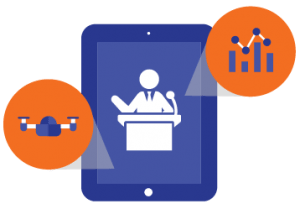
Map Sites in Minutes with Drone Mapping
Get your free demo of Identified Technologies’ drone mapping software.
Identified helps industrtial companies capture site data to effectively track production and profitability of every job site. Built specifically to allow you to plan, fly, and capture data to send for post-processing so that you can receive survey-grade data in a matter of hours.
Your FREE demo will include a walkthrough of our solution tailored for your industry’s needs. Complete the form and we’ll be in touch
During the demo you’re learn:
How we help you get survey-grade UAV photogrammetry 200x faster for tracking production and profitability in real-time.
What comes with a subscription to Identified Technologies.
Drone software features for the best UAV mapping and 3D modeling experience including Volume Calculation, Cut/Fill Heat Maps, Blueprint Overlays, and more!
Why industrial companies choose Identified…
“When compared to the new technologies, the drone flights report out data much quicker. Sometimes the very next day. That gives us the flexibility to be able to track it more closely and monitor it more efficiently.”
– Andy Rhodes, Superintendent, Kokosing Construction
Lower Cost of Ownership
Our subscription lets you map sites throughout entire projects, without the hefty in-house costs.
Secure Cloud-Based Platform
Access your drone data from anywhere securely. Drive collaboration and transparency between stakeholders and clients to track production and profitability.
First Class Support
We give you unmatchable customer experience by providing you a personalized plan to successfully integrate drone mapping operations. We’ll also help you pass the FAA 107 exam.
Not ready for a demo?
No problem! Download our awesome content.
The True Value of Drone Mapping
How much impact can aerial drone data really have on your business? Learn exactly how industrial leaders are using mapping drones to reduce project costs, injuries, and delays.
About Us
We help companies in construction and earth moving reduce costs and win more business with job site data and analytics. We empower ENR 400 companies, including with the ability to track progress on highways, well pads, mines, and landfills in near real-time.
We provide 2D data, 3D volumetrics, orthomosaics, as built versus as planned comparisons, as well as progress and cost forecasting and change detection. Our mission is to provide a new level of transparency and insights for the most difficult project management challenges.
Trusted By
© 2016 Identified Technologies