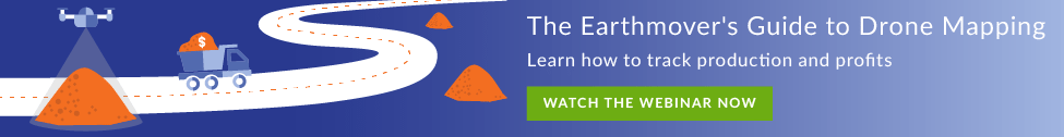
17 May 7 Drone Mapping Benefits Construction Companies Are Not Thinking About [Monthly Flyover]

When you think of drone mapping, what do you tend to focus on? Many construction folks we’ve spoken with concentrate on the drone itself at first. Don’t get us wrong, it’s essential, but there’s more to drone mapping than just the hardware. That’s why we sat down with our very own, Dan Veres, a drone mapping advisor here at Identified. Dan has an in-depth knowledge of what drone mapping offers and its benefits for construction.
What You’ll Learn:
Below we covered several points where Dan talks about the impact of drones on job sites that many construction and earthwork companies might not be thinking about.
Keep reading below to find out what Dan has to say about personnel, data accuracy, safety and more!
Q: How hard can it be to find good people? How does drone mapping impact the number of jobs that can be taken on without increasing headcount?
A: The labor shortage for construction companies is a growing concern. It’s why many are asking, “How do I grow my business with my current staff?”
Very quickly, they’re realizing drone mapping answers that question. For companies who do all their surveying and mapping in-house, the drone enables maximum production. Whereas traditional tools might limit a crew to how much area they can cover on foot in one day.
Being able to maximize the production of their in-house survey crews is one the key benefits of drones in construction.
If you have 10-15 job sites, that typically takes one or two weeks, or longer to map every location. With drone mapping, you could easily map those sites in a day with your existing team.
Q: Is it worth getting a drone map of a site before submitting a bid? What’s the goal in this case?
A: For almost every project, it’s worth doing a drone flight before you win the, bid or after to verify quantities.
In this specific use case, the goal is to understand how much earth needs to be moved to answer the question, “Was my bid accurate or was it inaccurate?”
It’s not a case of sending out a surveyor to walk the site or drive the entire area and shoot a point every 20-25 feet.
The mapping drone will capture a point every couple inches if you need something that dense.
We’ve seen incredible power with this for construction companies already using drones.
Being able to take accurate insights from the drone data, then compare it to your final grade model or your original surface to see how those two surfaces match up, brings clarity to the project.
Q: For construction companies already using drones, what’s a common problem they identify during these phases of the project?
A: Being able to capture survey-grade drone data on these job sites before the project even starts helps with project planning.
How many times do we start a project and halfway through, we realize we need more help? Typically, we recognize we need more people after the fact and by then the damage is already done.
That’s not the case with a drone mapping solution.
You fly the drone at the very start capturing an accurate map of how much dirt needs to be moved. Then it’s easier to plan the project and establish a timeline accurately. Hopefully, there won’t be any cases of needing to call in more heads or hire more people, but if you do, it’s not a surprise.
Q: How does drone mapping affect cash flow?
A: The goal is always to collect cash as quickly as possible, and at the same time, to bill for the amount of work you’ve done. Again, where the mapping drone immediately benefits a construction company is that you don’t need to guess earthwork quantities.
All that needs to be done is have the mapping drone capture data on a Friday (or Saturday), send it to the billing team the next day or beginning of the next week. Then they know the exact quantities were moved that week, month, or day.
With a construction drone solution, it’s never a case of billing too much or too little or even worrying if it will hurt you a couple of months down the road.
Now, you can say to the client accurately what amount has been completed for that billing cycle and what is owed. As a result, the handling of the project improves both concerning progress AND cash.
Q: What primary factors impact drone mapping accuracy?
A: Every job site is going to have some elevation on it or some other obstacle. When it comes to flight planning, if you’re using ground control points, it’s not how many ground control points you use.
It’s the placement.
It’s almost more important than the number of ground control points. That comes into play to a massive effect regarding data accuracy and precision.
If you’re not sure or you’re new to this, your customer success rep from the drone mapping solution you use can help decide where and how to lay the ground control points for the most accurate results.
Your final results can only be as accurate as the data you collect. The correct setup for the flight is just as essential as the post-processing and analytics.
Q: How does wind affect accuracy? What weather limitations should folks take into consideration?
A: What I usually tell people is if you would send a person out in it, you can probably send a mapping drone out in it.
I always tell folks flying on a perfect 70-degree day is easy because it’s ideal conditions. However, what happens when it’s -13 degrees? Alternatively, -20 degrees with the windchill and I have 30 mph winds?
That’s the real test.
One of my first drone flights was in Wisconsin in the middle of December and conditions were not ideal. So we had to adjust to ensure a safe drone flight.
On less than ideal conditions, my best advice is to create smaller drone flight plans with when temperatures are between 20-30 degrees on site. The drone’s battery life is not going to last as long. Also, during cold conditions, be sure to have battery heaters and keep them on or near the dashboard in a truck until it’s time to fly. Your drone mapping provider should provide you heaters upon request.
Q: When you’re having conversations with executive leadership with these companies, how do their needs or interests differ versus your talks with operational specialists?
A: I think every executive might have different use cases in mind, but it’s essential for them to embrace the speed, safety and savings drone mapping brings compared to legacy practices.
Construction is a market now where innovation and staying up to date with the technology is necessary for survival.
If you’re not doing it, one of your competitors is doing it.
In regards to folks involved in operations, a major item I like to highlight is improving their safety culture. Many of these folks have suffered injuries trying to climb a pile. Drone mapping pays for itself, letting you avoid these scenarios and keeps you safe.
If it prevents one accident, one injury, the technology more than pays for itself. The last thing anyone wants to do is have to restart at zero for the number of days since the previous injury on the chalkboard getting erased.
No Comments