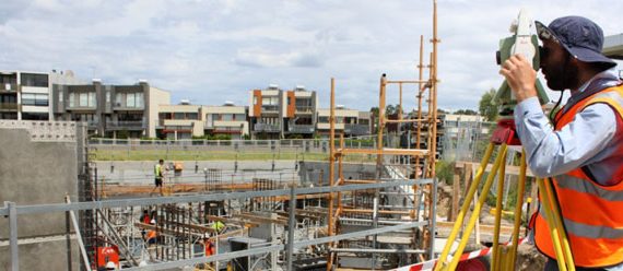
The ability to know the exact cost per yard and accurately predict profitability has always been more of an art than a science for construction projects. The most common way to track progress has historically been through manual surveying and aerial imagery from planes or helicopters. Unfortunately, these traditional options came with significant costs and delays. Each option could take weeks or even months from the time one reaches out to book the survey or flight to the time when data is returned. By then the job site has progressed and the old data no longer accurately represents where the job site is today. ...

Construction business owners sometimes live in a rearview world, where visibility into their work is retroactive, advance planning is nearly impossible and the bidding process is unnecessarily complicated. Until recently, the only way to measure cost per yard on a project had been a combination of estimates or guesses based off of previous work or truck counting. But with new technology, such as drone mapping and advanced data capture and processing, construction companies have an opportunity to turn their guesses into certainty when it comes to cost measurement, cash-flow analysis and bidding....

The search for faster and more affordable aerial topographical mapping has long been the “Holy Grail” for industries ranging from construction to mining to energy. Small, low altitude aerial surveying drones have shown the flexibility and reliability to be the ideal way to produce a map, drawing, measurement or a 3D model of any type of terrain. ...